Length of a Line
For the topographic map contest, you will be given a 7.5 minute series topographic map with a line drawn on it between two points on the map as shown in Photo 1 below.
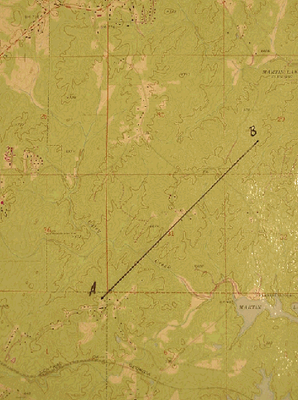
Photo 1
Lay a ruler down on the map parallel to the line (see Photo 2). Position the zero-end of the ruler at Point A and measure the length of the line in inches from Point A to Point B.
In this example, the line from Point A to Point B measures 4 inches in length. Located at the bottom of the topographic map is a scale similar to the scale in Photo 3.
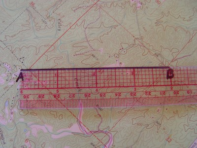
Photo 2
The scale of a 7.5 minute series map is 1 inch equals 24,000 inches or 2,000 feet. If the line measures 4 inches in length, it represents a distance of 8,000 feet on the ground; 4 inches x 2000 ft./in. = 8,000 ft.
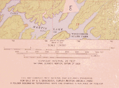
Photo 3
Continue reading how to determine a bearing.
