Map Symbols
Invitational participants will have to know the following 29 topographic map features and symbols for the topographic map contest. You will identify 10 features or symbols during the contest from the following list:
ridge
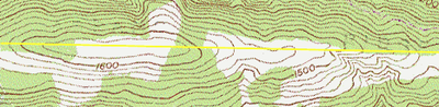
The yellow line represents the top of the ridge.
valley
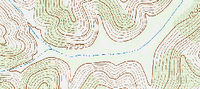
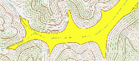
In this example an intermittent stream runs through the base of the valley. The two pictures are identical. The picture on the right has the valley boundary shaded in yellow for ease of identification.
peak
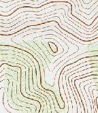
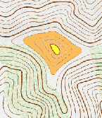
These two photos are identical. The knob or peak is depicted by the yellow area. The orange area is the boundary of the slope leading up to the knob or peak of this hill.
saddle
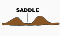
A saddle is the bottom of the slope between two hills. The yellow areas represent the knobs or peaks of two hills. The orange area is the saddle.
depression

woodland

open area
primary highway

unimproved road
bridge
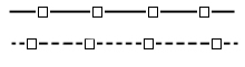
trail

school

tank

house of worship

quarry

building


campground

cemetery

marsh

spring

perennial stream

intermittent stream

power transmission line
gravel pit

mine tunnel

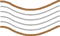
index contour line
intermediate contour line
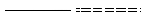
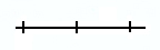
railroad - single track
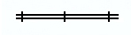
railroad - multiple track
You can view topographic maps and print them off from any state in the U.S. from USGS.gov.
Download this page as a PDF.
The following publication “USGS Topographic Map Symbols” was used as a reference for this section of the contest. You will not be tested on any of this additional material. We are providing it here only for those interested in additional map interpretation symbols.
