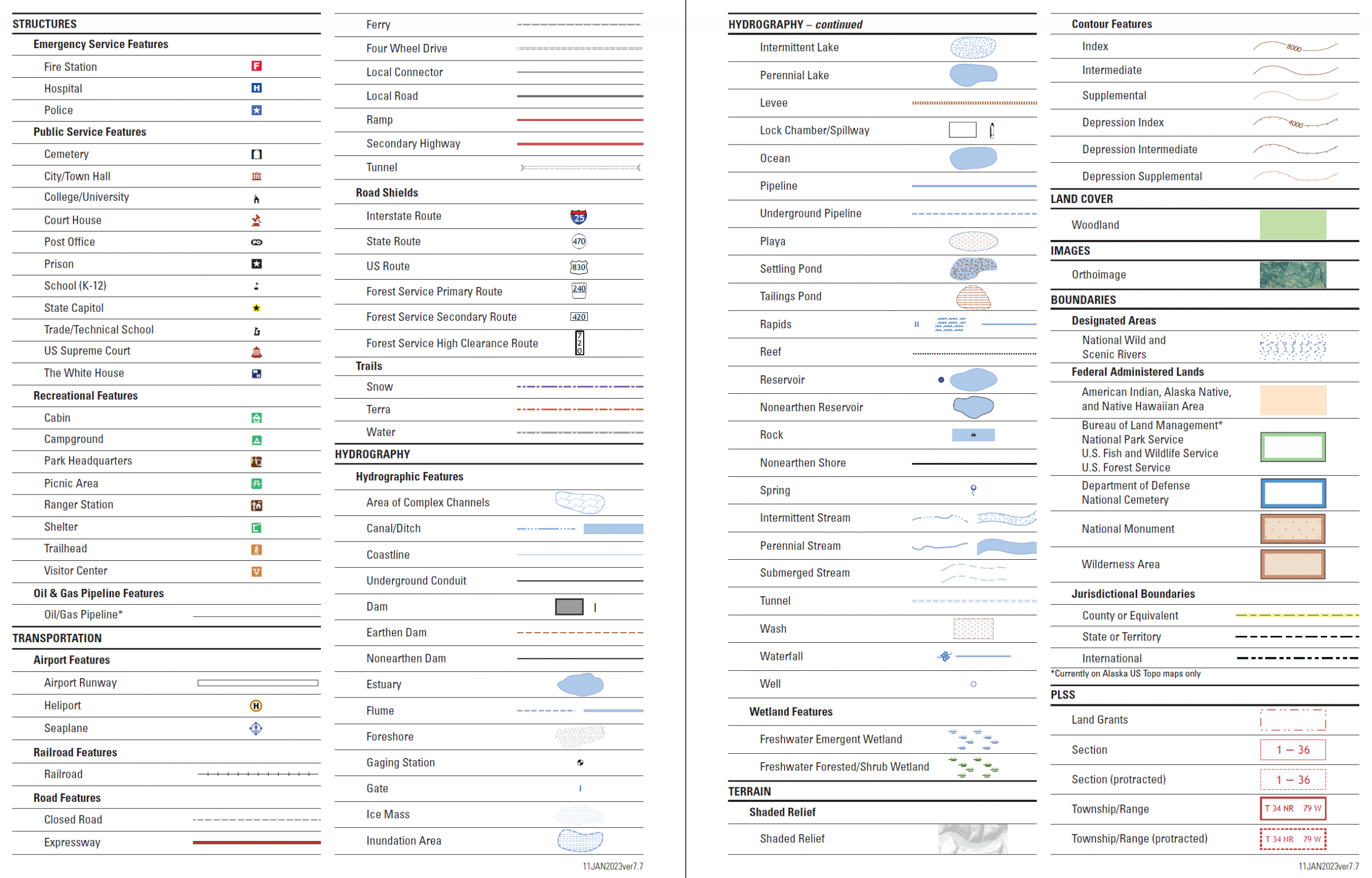
Topographic Map Contest References

Invitational participants competing in the topographic map contest will complete the following four parts of the contest event:

  1. Determine the length of a line established between two points marked on a topographic map using the map scale
  2. Determine the bearing (line of travel) between the two points using a Silva Range-type Azimuth compass or equivalent
  3. Correct the above bearing for declination.
  4. Identify 10 topographic map symbols marked on the contest map from a list of 29 topographic map symbols selected specifically for the Invitational contest
  5. Determine the difference in elevation between two points.

The following links are the official training references which describe how to do the four parts of the contest above. You are to use these links below to study and train for the topographic map contest: